Battlefield Trek

BATTLEFIELD TREK


 This is a two-mile-long educational hike through some of the most interesting area of Shiloh National Military Park. This short, easy, and informative hike is designed especially for Cub Scouts, Junior Girl Scouts, and other young hikers not old enough to be eligible for the much longer Shiloh Military Trails (which is 14 miles longer and is for hikers at least 11 years old). The Shiloh Battlefield Trek is designed to introduce young hikers, their parents, and group leaders to the historic battlefield of Shiloh and show them where some of the fiercest fighting occurred. Included on the route are such famous Shiloh landmarks as the Hornets' Nest, Sunken Road, War Cabin, Peach Orchard and Ruggles' Batteries. A leader of a group desiring to hike the Shiloh Battlefield Trek should write to the Shiloh Military Trail Committee several weeks in advance of the proposed hiking date and request a map for his group. The hiking information and credential cards can be printed from the web site. Please order enough maps so each leader may have one. You will need to print the credential card and copy this so that each hiking participant has one to complete.

Use Part A of Unit Application to hike Shiloh Battlefield Trek to order maps and other printed materials. 

SUGGESTED SCHEDULE

A. First, go to the Park Visitor Center. See the movie (shown daily every 45 minutes). Visit the Museum and look up some answers to questions asked (record answers on your credential card). 

B. Start the self-guided auto battlefield tour - use park brochure for map. When you reach Hornets' Nest Road (just past U.D.C. Confederate Monument) turn left and proceed to the center of the Hornets' Nest and park your car there. 

C. No take the Shiloh Battlefield Trek. This is a figure eight shaped route, and you will finish back where you began after hiking approximately 2 miles. 

D. Then complete the balance of self-guided auto tour of the battlefield.  This is not required, but your group may like to take other short hikes at other stopping points - as from - Shiloh Church to the Tennessee Monument - the Indian Mounds Trek - and possibly others.

MISCELLANEOUS

A nice picnic area is available in Sowell Field - located on the west side of Highway #22 about one mile south of the main entrance to the park. 

NO WATER is available along the auto tour or trek route (except at Visitor Center) so canteens may be desirable in hot weather.

Two restaurants (The Back Porch and the Shiloh Battlefield Cafe) are located near the intersection of Tennessee Highway @22 and @142 near the southwest corner of the park.  Souvenirs are available at Ed Shaw's Shop.

ALL SHILOH MILITARY TRAIL HIKES ARE APPROVED BY B.S.A. NATIONAL CAMPING SERVICE.

REQUIREMENTS FOR AWARDS:

  1. Read (or listen attentively to it being read) the story which accompanies the hike directions. It is recommended that this be read aloud by a leader to a hiking group before, then again as the hike is made.
  2. Take the self-guided automobile tour of the battlefield as per the National Parks Service map and brochure given out in the Visitor Center.
  3. Take the entire hike exactly as specified.
  4. Each hiker fills out his own Credential Card as he makes the hikes. Each is to write answers to questions asked on the Trek Instruction Sheet. 
  5. Visit the Shiloh National Military Park Visitor Center and Museum and while these see the movie "Shiloh - Portrait Of A Battle".
  6. Abide by all rules of the Shiloh Military Trail Committee and the National Parks Service at Shiloh National Military Park. 

A. All hikers must be under the supervision of a responsible adult leader at all times while in Shiloh National Military Park. Scout groups should wear uniforms.

B. Hike Safely, be especially careful when hiking along or crossing roads.

C. Do not leave any litter along the way. Be a good example for other park visitors. It is recommended that hikers do a good turn by picking up any litter observed on the route and placing it in trash cans located throughout the park.

D. Be courteous, orderly, and most cooperative when visiting indoor areas such as the Visitors Center, Ed Shaw's Restaurants, the Park Book Store, ETC.


AWARDS:

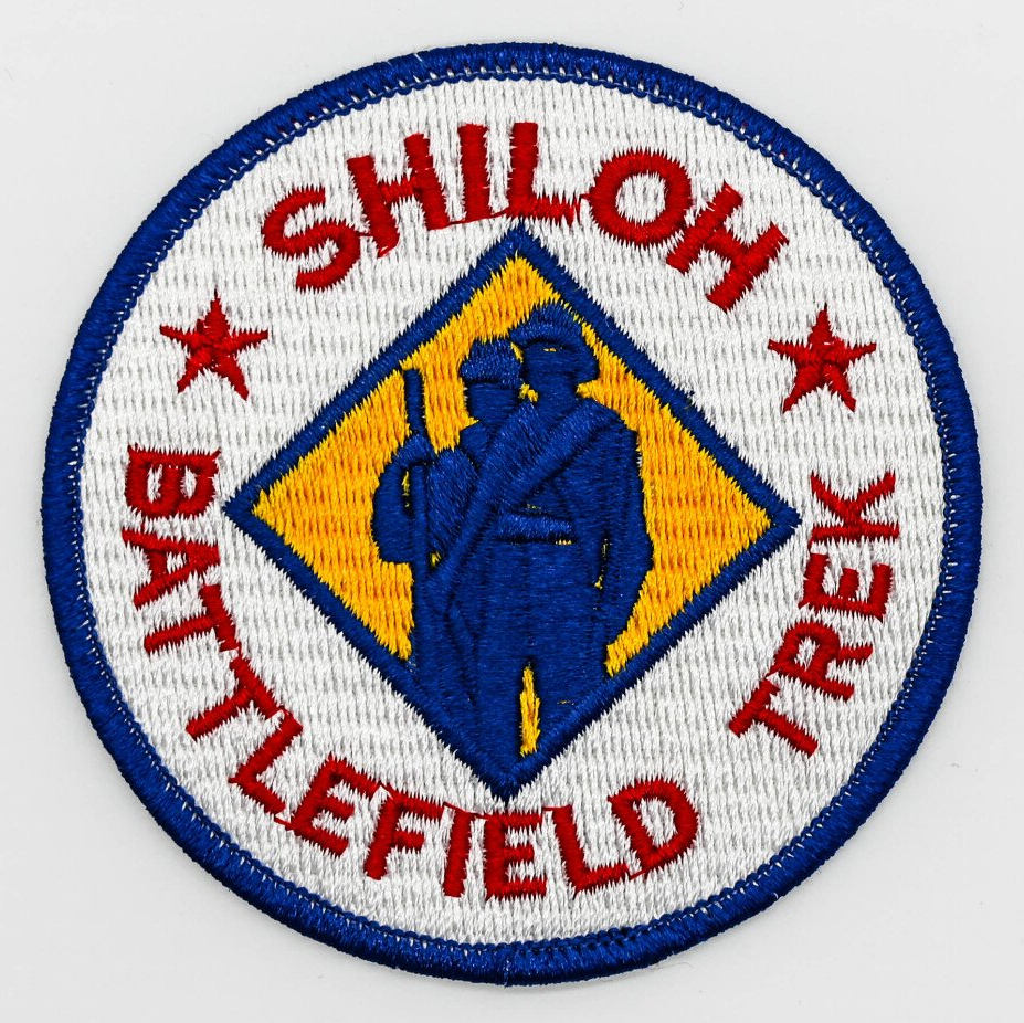
An Attractive Shiloh Battlefield Trek patch, (pictured) about 3 1/2 inches diameter and fully embroider in for colors, is available.

Also, a small blue and gold lapel pin (about 1/2" diameter) or similar charm bracelet pendant is available.

Purchase of any trek awards is optional.

SHILOH BATTLEFIELD ANSWER CARD

Download Now

SHILOH BATTLEFIELD

MAP

Download Now

BATTLEFIELD HIKING INSTRUCTIONS

Download Now

Shiloh Battlefield Trek Hiking Instructions


Start

Start with the visit to the Museum and watch the movie there. Check in with the park rangers and obtain a map so you can take the Guided Auto Tour.

While in the Museum answer questions 15 - 18 on your answer card.


  • Question 15:

    See the "After the Battle" display containing a Union Battle Guidon picked up on the battlefield the day of the battle. How many stars are shown on this flag?

  • Question 16:

    See the Drummer Boy of Shiloh display. What was his name and age?

  • Question 17:

    See the "Cannon Roar" display. What was carried in the two buckets you see here?

  • Question 18:

    See the diorama (model scene) showing fighting in the Hornets Nest. How many men are shown firing the cannon?


Begin Trek

Hike leaders - refer often to your Trek Map as you follow the Hiking Instructions. A compass may be helpful.

The Shiloh Battlefield Trek begins and will end at the intersection of Eastern Corinth Road and the entrance to Hornets' Nest road (a gravel road.) Park your cars nearby and keep roadway clear.


  • Map Location 1: Start of Trek

    Stop! Look around you. What do you see there in the forest? Listen! What do you hear? Is the wind rustling through the trees? Are there birds singing, crickets chirping - or maybe even a frog croaking in the distance? Smell the fresh forest air.


    You are hearing the sounds of the land - seeing a forest at rest. But what happened at this spot almost 150 years ago? What would the sights and sounds have been during the Battle of Shiloh? What would it have been like to smell the air filled with smoke and gunpowder? The movie you saw at the Visitors' Center would help you to imagine the fighting that once shattered the quiet of these woods.


    Question 1: What was the date of this fighting?

  • Map location 2

    Follow the nearby path a short distance southeast into the woods. The worn strip by the path is Sunken Road, which once served the needs of the few families that lived along its two mile length. Dust rose from ever-deepening ruts in dry weather to sting the eyes and throats of these who used it. Frequent rains turned the dust into mud, causing iron-rimmed wheels to sink axle-deep as work horses strained against their harnesses. Both the North and the South used roads similar to this one to move long lines of men and supplies from one point to another, but this road was to serve another need. Its deep ruts offered a small amount of protection to hard-pressed Union soldiers who fell back before a deadly line of Confederate guns. This was a place to stop and make a stand while there was still a chance. Union soldiers were shoulder to shoulder along the length of Sunken Road. Here they waited for the wild Rebel charges that they knew would come.  In the hours that followed, some of the most severe fighting of the Civil War took place along this once peaceful farm road.


    No question to answer here. Proceed to map location 3

  • Map Location 3

    Follow Sunken road until you see a tall monument for the 31st, Indiana Infantry on the right.  Often it is the land that sets the final rules for a battle and so it was at Shiloh.  The woods may seem thick today both they were even thicker in 1862.  Swift striking cavalrymen watched impatiently as the battle developed both their horses were nearly useless in the thick woods and dense underbrush. Shiloh was to be a battle of infantrymen - a face to face fight between foot soldiers.  Soldiers dropped under the steady hail of bullets that ripped through these woods.  For six long, costly hours the Union forces held along the line of Sunken Road.  some weakened under the deadly Rebel attack and fled to the rear, but for the rest there was little time for thoughts of running.  Load, fire, reload and fire again - these were the only thoughts that remained.  At best, most men could only load and fire their heavy muskets three times in one minute, but that was enough to leave hundreds of dead and wounded scattered across Shiloh's tangled grounds.  Perhaps the losses of the 31st.  Indiana Infantry at this spot will help you to better understand what it was like for the men who once faced each other through these woods.


    Question 3: What was the total number of mem lost (killed, wounded, and missing) here by this unit?

  • Map Location 4

    Hike a little further along Sunken Road and you will see a cleared strip leading to the right through the woods. Follow that strip to a monument for the 44th Indiana Infantry. Modern military commanders are seldom farther from help than the nearest two-way radio.  But Civil War leaders had to depend on the speed and skill of a trusted messenger to send for reinforcements. Answers often took hours and even days in coming. Others were erased forever by s sniper's bullet. Poor communications were one reason why Civil War battles were so often fought by long lines of yelling soldiers who charged time and again directly into a deadly wall of enemy shot and shell. Radios were unheard of but the flash of a saber and the sight of a battleflag was all the signal needed by the men who stood in those hard fighting lines. The battleflag played an important role in the fighting at Shiloh. It gave the soldiers a point to line up on and most men would follow it as long as it could be seen through the smoke of the battle. Great pride was placed in a battleflag and many men lost their lives trying to protect their unit flag or trying to keep it moving forward. If a flag bearer was hit another man would immediately sweep the flag from the ground and move on with it. Anyone who carried the flag into battle became a target for every enemy gun but many a soldier ignored this threat as he carried his flag into a hail of enemy bullets.


    Question 4: How many of the 44th Indiana Infantry lost their lives here while carrying their battle flag?

  • Map Location 5: War Cabin

    Follow the cleared strip on around until you come out at the edge of an open field.  The old cabin you see across the field stands empty and quiet now, but it wasn't always that way.  Imagine an early morning here a few weeks before the Battle of Shiloh.  A rooster would have welcomed the new day from a nearby tree.  And perhaps a droopy eared hound would have moved from his bed on the front porch  to sniff the fresh morning air.  Soon smoke would curl from the chimney and the aroma of frying bacon would drift across the freshly plowed fields.  Next would come the laughter of children as they arose from their beds in the cabin loft.  Soon breakfast would be over and there would be work to be done.  Spring was on its way and the fields had to be planted or there would be no cotton or wheat or corn when the winter winds came once again.  A few weeks later those fields were pounded under the feet of hundreds of soldiers and torn by the wheels of cannons.  The nearby peach orchard had been prized by those who lived here but the blossoms were cut by bullets that spring to fall softly on the bodies of dead and dying soldiers.  Even the cabin fell - destroyed by fire and exploding cannon balls. The family had escaped but their home was gone.  Still, the land was there and it would grow more crops.  The land was the most important.  The cabin could be rebuilt.  The bullet scarred logs of another cabin were moved here to build the house you see today.  bitter memories remained but life had to go on.  Look closely at the cabin to see how it was built.  Notice how wood pegs were used in place of nails.


    Question 5: What was used to make the fireplace and chimney?

  • Map Location 6: Bloody Pond

    Follow the path leading through the woods behind the cabin.  It will lead you to a pond next to a paved road.  The first of three Audio Message Stations you will hike by on this trek is located between Bloody Pond and Hamburg - Savannah Road.  Push the button and listen to this information.  (Note: these stations are not in operation during winter months.)  The first people to see this pond may have been Indians who watched silently from the forest edge in hopes a deer would come to drink.  Much later, settlers depended on the pond for water to fill their daily needs and water their livestock.  the names of those who know and depended on these spring-fed waters have mostly been forgotten.  But the pond itself will be remembered for years to come because of the fighting and suffering which once surrounded it.  Wounded soldiers made their way here to drink and bathe their wounds.  Some were strengthened but many fell face down, never to rise again.  The blood of Yankee and Rebel alike slowly blended to turn the water a deep read.  From that day on the name of Bloody Pond would be a part of American history.


    Question 6: On what day did this local citizen visit the battlefield?

  • Map Location 7

    You will find another path at Bloody Pond. Follow it until it turns at the edge of a field. Hike across Wicker Field to reach two cannons and a stone monument which can be seen in the far corner. The monument will be for Illinois Battery F. See your map. Like all wars, the Civil War changed many lives. Husbands, brothers, fathers, and sons marched away to battles such as Shiloh. Many of them never returned. Others returned but were never the same. Still, there were some who never lost their dreams in spit of the hardships of war.


    One such man was the captain who commanded the cannon which fired from this spot. He lost an arm at Shiloh but he still went on to become a famous western explorer and a nationally know scientist. This man led the first expedition ever to follow the Colorado River through the rugged and dangerous Grand Canyon. He did with one arm what most men would not have dared with two arms.


    Question 7: What was this captain's name?

  • Map Location 8

    Follow the path from the last stop back to a point where it branches to the right. Follow this branch a short distance into the woods and stop.


    Thousand upon thousands of men wore the blue and gray uniforms of the Civil War. It was a hard life. Long hours of guard duty and dull camp life were often followed by mile after mile of marching through ankle - deep mud or clouds of choking dust. Days and even weeks sometimes passed without any real fighting but the threat of battle was always there. Soldiers on the move often lived in the open with little or no shelter. A man's gear often dropped to just his musket, the clothes he wore and whatever he could carry in his pockets. A tent and a dry bed became something to dream about during the long hours of a rainy night. Uniforms quickly became worn and dirty and shoes wore paper thin. The biting of lice and fleas added to the discomfort and sickness was always a danger in the crowded camps. Doctors were scarce and a battle wound could mean the loss of a leg or an arm - or worse.


    Food was often scarce.  Each man usually gat a small supply of coffee, flour and bacon and the cooking was left up to him.  At times he was hungry.  Remember the cabin you visited and the small mall field you just crossed?  The people who lived there would have owned chickens, pigs and maybe even a cow or two.  It was hard on the farmer, but the small farms sometimes offered the only food available to a fast moving army.


    Look at the forest around you. You may see only trees, bushes and small plants, but to a country-born soldier of the Civil Was those same trees, bushes and plants meant as much as a trip to the grocery store or drugstore today. Many nuts, berries, roots and leaves could be eaten. Others could be crushed into a powder and used to treat everything from sore feet to malaria. There were even twigs that could be peeled and rubbed against the teeth to remove tobacco stains. A wood-wise soldier could find dozens of this to make life a little easier.


    There is no question for Map Location 8

  • Map Location 9

    Continue along the path to reach two cannons and a yellow oval plaque for Mendenhall's U.S. Army Batteries near where you began your hike. Cannon fire was common during the Civil War but caused only a small part of the casualties at Shiloh. The artilleryman didn't make the shoulder to shoulder charges that the infantryman made but his duties were every bit as dangerous. It was not unusual for the enemy to make a mass charge directly toward a cannon. This was as dangerous for the charging infantry as it was for the artillerymen. An artillery crew sometimes fought hand to hand rather than five up their gun. Hard, backbreaking work filled the life of an artilleryman. A single mistake by any crew member could have cost his life or that of a fellow soldier. The only way to load and fire safely was to put in endless hours of practice and drill no matter where they were or what the weather was.


    Question 9: When were Mendenhall's batteries engaged here?

  • Map Location 10

    Return to the center of the gravel road.


    You will soon be back to your starting point in the center of the Hornets Nest. Some of the most costly fighting at Shiloh took place in this area and several states have put up monuments to honor their men who fought here. Among the monuments in the center of the Hornets Nest are three showing the Infantryman, Flag bearer and Artilleryman. Read about them. As you look at the statues on the monuments think of them as living soldiers. Try to imagine what they thought and felt during the Battle of Shiloh. Think about how you would have felt if you had been in their shoes. Discuss this with your leader.


    Question 10: Locate three monuments which represent the flag bearer, the infantryman, and the artilleryman, in that order. What States sponsored each of these monuments?

  • Map Location 11: Sunken Road

    The next section of your hike will begin back on Sunken Road at a point near the rail fence and the Minnesota Monument. The hundreds of men who crouched behind the twisted rails of this fence knew it would offer only a little protection from the bullets that would come. Shoulder to shoulder they waited with guns aimed across the open field. Then it came! Suddenly the air was filled with the chilling yells of hundreds of charging Confederates. Bullets buried themselves in the fence rails and threw splinters into the faces of the crouching riflemen. The Yankee line fired as a single unit and a deadly wall of shot and shell slammed into the charging Rebel lines. The kneeling soldiers moved back to reload and a second lin3e of riflemen stepped forward to kneel and fire. Time and again the Rebel troops charged toward the thin Union lines but it was no use. Bullets poured from the Sunken Road with the angry whine of a thousand hornets. Those that lived would never forget that whine of the fighting that went on at the place know simply as the "Hornets nest".  Follow the rail fence to its end at Corinth - Pittsburg Landing Road.  (Note the question below)   Stop along the way at the different monuments to read of the losses of the units who held this line.  Crouch behind the rail fence and try to imagine yourself as one of hundreds of soldiers waiting for the charge that could mean death for you or the man next to you. Listen to the audio message located here.


    Question 11: How many Iowa monuments did you hike by here.

  • Map Location 12: Ruggles' Battery

    When you reach Corinth - Pittsburg Landing Road, turn and walk across the field to the line of cannons on the other side. Hike across the field near the road but do not walk on the road. See the display of Ruggles' Batteries and listen to the Audio Station. Time and again, long lines of Rebel infantrymen charged across this open field only to be driven back. Each time they left more of their dead and wounded behind on the open field. General Daniel A. Ruggles watched with growing concern. Sunken road had to be taken but it would have to be done in a different way. Messengers were sent out to gather every Southern cannon they could find. By mid afternoon a line of cannons stood nearly hub to hub along the edge of this field. Never before had so many cannons been massed in an American battle. The stubborn Yankee line was unable to hold under the deadly blasting that followed. Southern infantrymen swept across the field once again but this time the enemy could not hold. General Ruggles had made a decision and it had worked. Much time and many men had been lost but the attack was moving once again.


    Question 12: How many cannons were there in Ruggles' line?

  • Map Location 13

    Walk down the line of cannons until you come to the plaque for Washington (Louisiana) Artillery.


    Question 13: How long was this battery in action here?

  • Map Location 14

    Ruggles line is silent now, but imagine how different the scene would be if you added over 400 artillerymen, over 300 horses and about three times as many cannons as you now see. Add to this the several hundred infantrymen who had been charging across the field and you can get some idea of the confusion that must have existed here. A full Civil War gun crew had as many as eight men to handle all the steps of loading and firing. They used up to six horses to move a cannon and its ammunition cart which was called a caisson. When coupled to its limber the caisson became a four wheeled vehicle. Tools and items necessary for firing the cannon were carried on the limber. There were several kinds of cannon in the same unit and this meant that there had to be several kinds of ammunition to fit them. Look carefully at the two guns in front of you and you will see that they are not the same. The problems of moving a large number of men, horses and cannons were many. General Ruggles knew this when he ordered Southern guns to form along this line, but there was no other choice. A mistake could have meant the loss of hundreds of men but no decision at all could have been even worse.


    Continue along Ruggles' line until you come to the plaque for Bankkead's Tennessee Battery.


    Question 14: When did this battery go into action here?

  • The Charge

    Look across the empty field in front of you. What did you think about as you crossed that field a few minutes earlier? Were you thinking of the men who once died there or were you thinking of something else? Tell your leader.


    The Trek now goes back across that open field to Sunken Road but this time you will not go as a hiker. You are now a Rebel infantryman standing on line with your fellow soldiers. The fighting has been hard all morning and some of your friends were hit, but you were lucky. You are tired and scared and your shoulder hurts from firing your musket but you will go on. The word coming down the line is that the Yankees have stopped running and are waiting at the edge of those woods. This time there won't be any surprise. They will be ready and the attack will be costly. In fact there may be a gun aimed your way right now.


    Look at the men who stand beside you. Will they still be there after the charge or will even your own luck run out before you can cross that field? The command to move up on line cuts short any further thoughts you might have had. Quickly you check your musket to be sure it is ready and the you glance to your right to line up on a battleflag tattered from earlier charges. You look to the left in time to see your commander ride to the front and slowly look up and down the long line of soldiers. The time has come! The commander's saber flashes in the sun and the cry to charge echoes down the line. There is no longer any time for thoughts of fear. You are running now and shouting at the top of your lungs The enemy must be driven back.


    MOVE OUT, SOLDIER!


    No question to answer here

  • Final Checkpoint

    You should now be back at the rail fence and Sunken Road. You have been hiking over ground where thousands met in some of the hardest fighting of the Civil War. Along the way you have learned of the hardships and problems of both the Civil War Soldier and the land owner who was caught up in the battles. As you hike the short distance back to your cars take a few minutes out to think of the people who fought and lived here. Times have changed many things but what about the people themselves? Were they really any different from you and the people you know today? Tell Your Leader.

Share by: