Compass Trail 4A

COMPASS TRAIL 4A

Green - Even Years


The Shiloh Military Trail Hike No. 4A is a Compass Hike.

This is a rugged country hike. Shiloh battlefield has much thick undergrowth present today--just as it did before the great battle occurred there. Snakes are also present during warm weather so be prepared for such. This trail is especially recommended during fall and winter seasons when undergrowth and leaves are not as thick, visibility better, and cross-country hiking much easier. However this Compass Trail can be hike any time during the year you care to tackle it.

A good compass including knowledge of how to use it is a must. A liquid-filled compass is highly recommended, as it will increase your speed in taking accurate bearings. ALL DEGREE READINGS GIVEN IN INSTRUCTIONS ARE MAGNETIC READINGS--THEREFORE NO CORRECTION IS REQUIRED FOR MAGNETIC READINGS--therefore no correction is required for Magnetic Declination. Set compass to the reading given as an accurately as possible for each azimuth. Distances given in instructions are approximately only. The length of each compass leg was scaled from a map (to the nearest 50 ft.) so Is "flat land" distance and no allowance was made for hills and ravines. You should know how to offset your course around obstacles. CONSULT YOUR MAP FREQUENTLY TO CHECK YOUR LOCATION AND ROUTE. If you should get lost either try to return to your last point or go to the nearest road and determine your location. If you should encounter high water anywhere along the trail consult your map and take a route on roads to get you around the water and to the next plaque or monument sought.

REQUIREMENTS

1. Hike the entire compass trail as specified on foot following all instructions given.

2. Write answers to the questions asked about the plaque and monuments visited and submit the completed credential card for this hike.

3. Read the interesting four-page newspaper reprint (by Paul Vanderwood for the Memphis Press-Scimitar) describing the Battle of Shiloh. This reprint is available from the Shiloh Military Trail.

ROUTE

Start early--this trail takes time. Go by buddies or groups and not alone. Wear long pants and boots (or good leather shoes). In summer carry a snake bite kit. Take a canteen and pencil--both needed. Each group should be equipped with a first aid kit.

LEADERS--please see that there is NO SMOKING in the woods. We must practice fire prevention at all times. This hike is thru woods and fields, which are often very dry. Leaders must see that no one in their hiking group smokes along this trail.

PLEASE READ ALL OF THESE INSTRUCTIONS CAREFULLY! THEY ARE IMPORTANT.

Before making this hike, again read the Rules on Part B of the yellow unit application blanks concerning Scout conduct. Remember no rock throwing; do not mark on any monument or plaque; be a credit to Scouting.

DO NOT CUT OR BLAZE THE TRAIL - Leave the woods and trees as undisturbed as you found them. Do not discard paper or trash in the woods.

ALL SHILOH MILITARY TRAIL HIKES ARE APPROVED BY B.S.A. NATIONAL CAMPING SERVICE.

REQUIREMENTS FOR AWARDS:

  1. Read (or listen attentively to it being read) the story which accompanies the hike directions. It is recommended that this be read aloud by a leader to a hiking group before, then again as the hike is made.
  2. Take the self-guided automobile tour of the battlefield as per the National Parks Service map and brochure given out in the Visitor Center.
  3. Take the entire hike exactly as specified.
  4. Each hiker fills out his own Credential Card as he makes the hikes. Each is to write answers to questions asked on the Trek Instruction Sheet. 
  5. Visit the Shiloh National Military Park Visitor Center and Museum and while these see the movie "Shiloh - Portrait Of A Battle".
  6. Abide by all rules of the Shiloh Military Trail Committee and the National Parks Service at Shiloh National Military Park. 

A. All hikers must be under the supervision of a responsible adult leader at all times while in Shiloh National Military Park. Scout groups should wear uniforms.

B. Hike Safely, be especially careful when hiking along or crossing roads.

C. Do not leave any litter along the way. Be a good example for other park visitors. It is recommended that hikers do a good turn by picking up any litter observed on the route and placing it in trash cans located throughout the park.

D. Be courteous, orderly, and most cooperative when visiting indoor areas such as the Visitors Center, Ed Shaw's Restaurants, the Park Book Store, ETC.


AWARDS:

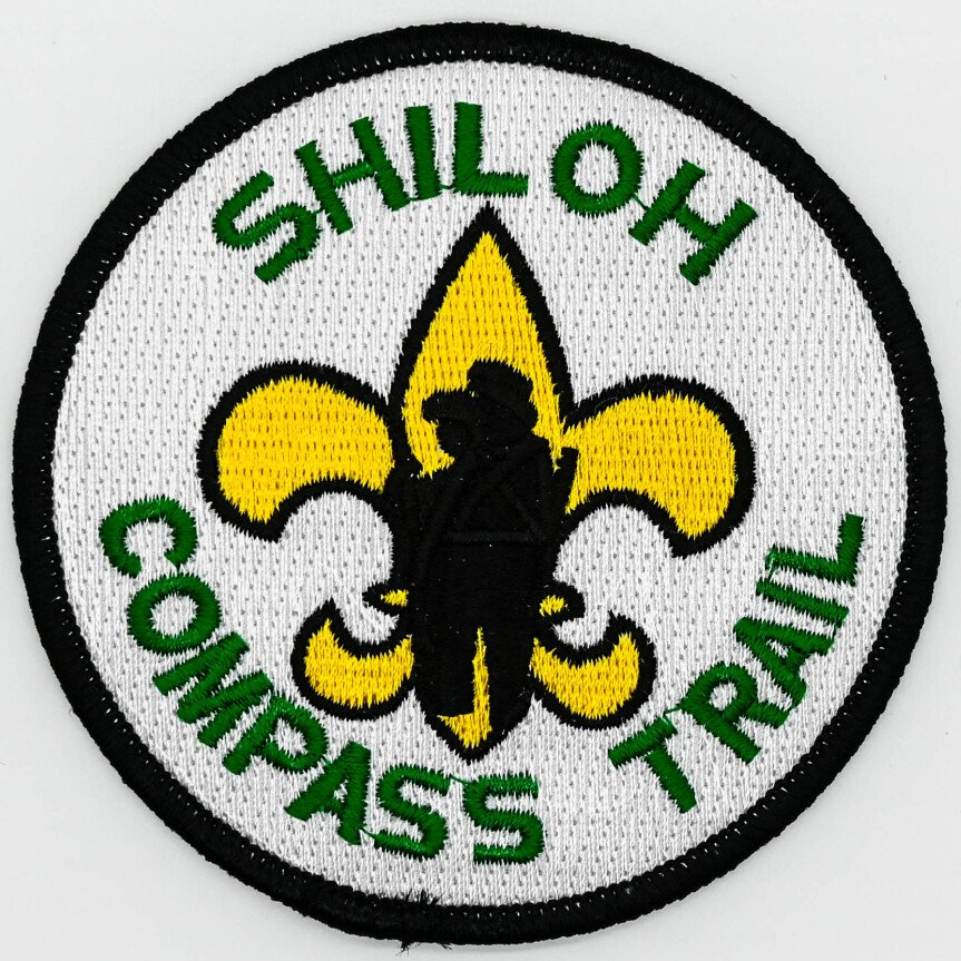
Upon successfully completing the requirements for the Shiloh Military Trail Compass Hike you are entitled to purchase, if you wish and attractive Compass Trail patch.. This patch is fully embroidered in four colors and is 3-1/2" diameter. Small pin also available. 

COMPASS TRAIL #4A

ANSWER CARD

Download Now

COMPASS TRAIL

#4A MAP

Download Now

COMPASS TRAIL #4A INSTRUCTIONS

Download Now

COMPASS TRAIL 4A Hiking Instructions


Start

START AT SMALL CONCRETE MARKER LOCATED ABOUT 23 FT. EASTt(135 deg) OF THE ENTERING SHILOH NATIONAL MILITARY PARK SIGN LOCATED ON TENN. HIGHWAY #22 NORTHWEST OF PEACH ORCHARD RESTAURANT.

THIS MARKER IS LABELED 'HWY RW'.


  • Question 1:

    From the HWY RW  concrete marker hike 58 degrees for 1900 ft. to a read plaque for 2nd and 7th Arkansas Inf. (Shavers' Brigade, Hardee Corps) in the wood on the west side of Seay Field.   

     AT WHAT TIME OF DAY DID THESE TWO COMPANIES SEE SKIRMISH ACTION HERE ON APRIL 6, 1862? 


    (Note: If the 2nd and 7th Ark. Inf. plaque was missed in the woods, a blue plaque in Seay Field for 21st Missouri telling the name of first officer killed in Battle of Shiloh is easily found. From this blue MO. Plaque hike back 220 degrees for 650 ft. to locate a red Arkansas plaque. Also from this blue MO. Plaque in Seay Field you can hike 310 degrees for 600 ft to reach the "Two Cabins" plaque.)

  • Question 2:

     From this red plaque hike 358 degrees for 800 ft. to locate the "Two Cabins" plaque. Notice the mound of earth, which locates the site of the old chimney.    AT WHAT TIME DID GEN. A.S. JOHNSTON OCCUPY THIS POSITION?

  • Question 3:

    From here hike 90 degrees for 1500 ft. to a bridge in Reconnoitering Road over a small creek. From the southeast corner of the bridge hike 192 degrees for 100 ft. in the woods to locate a blue plaque.    

    WHO COMMANDED THIS UNIT?

  • Question 4:

    Now return to the bridge on Reconnoitering Road again. From the same corner of the bridge now hike 67 degrees for 1750 ft. to locate a read plaque telling about Shaver's Brigade attack on Peabody Brigade.    

    HOW LONG AN ENGAGEMENT WAS REQUIRED TO CAPTURE THIS UNION CAMP?

  • Question 5:

    From here hike 101 degrees for 1400 ft. to reach the Gladden Mortuary Monument.    

    COPY AS SHOWN HERE GEN. GLADDEN'S FULL NAME AND RANK.

  • Question 6:

    From here hike 49 degrees for 600 ft. to reach a small black plaque in Spain Field marking the location of the camp of the 18th Missouri Infantry.    WHAT WAS THEIR FIRST POSITION IN LINE OF BATTLE ON APRIL 6, 1862?

  • Question 7:

    From here hike 30 degrees for 1300 ft. to reach Prentiss Hdqs.    

    COPY THE WORDING ON THIS MONUMENT.

  • Question 8:

    From here hike 47 degrees for 1300 ft. to reach a red plaque on the north side of Hamburg - Purdy Road for Stephens Brigade telling about a charge made across this field at 2:30 PM on April 6, 1862. 

    WHAT FIVE UNITS TOOK PART IN THIS CHARGE THAT DRIVE THE UNION LINE BACK FROM ITS NORTH SIDE?

  • Question 9:

     From here hike 322 degrees for 900 ft. to reach a red plaque telling about a charge made by N.B. Forrest's Tennessee Calvary.    

    WHAT ALABAMA UNIT ALSO PARTICIPATED IN THIS SAME ENGAGEMENT?

  • Question 10:

    From here hike on 357 degree for 1000ft. to reach the Indiana 31st Inf. Monument located near Sunken Road.     

    WHAT IS THE NAME OF THE COLONEL WHO WAS WOUNDED WHILE COMMANDING THIS UNIT?

  • Question 11:

    From here hike 282 degree for 950 ft. to reach Putnam's Stump Monument located on Eastern Corinth Road.    

    WHAT KIND OF TREE WAS THE ORIGINAL PUTNAM'S STUMP?

  • Question 12:

     From here hike 318 degrees for 1500 ft to reach the Illinois 8th Infantry Monument near Ruggles' Batteries. Three captains are shown as having commanded this unit, one was wounded, another killed.    

    WHAT IS THE NAME OF THE THIRD CAPTAIN?

  • Question 13:

    From here hike on 62 degrees for 700 ft to reach the Iowa 2nd Inf. Monument located near where the Sunken Road meets Corinth - Pittsburg Landing Road.    

    HOW LONG DID THIS UNIT HOLD THIS POSITION ON APRIL 6, 1862?

  • Question 14:

     From here continue along Corinth - Pittsburg Landing Road on 68 degrees for 900 ft to reach the W.H.L Wallace Mortuary Monument.    

    HOW LONG DID GENERAL W.H.L. WALLACE LIVE AFTER BEING MORTALLY WOUNDED HERE?

  • Question 15:

     Continue on along Corinth - Pittsburg Landing Road on 58 degrees for 1200 ft to reach the U.D.C. Confederate Monument. Observe the bust of General A.S. Johnston located in the center of the Monument.    

    WHAT COMPASS DIRECTION IS GEN. JOHNSTON FACING?

  • Question 16:

     From here hike on 359 degrees for 2000 ft to reach a small Confederate Burial Trench on Cavalry Road. (Don not cross Cavalry Road). Most of the other Confederate Burial Trenches have a number of cannon balls all around the edge.    

    HOW IS THE OUTLINE OF THIS PARTICULAR TRENCH MARKED? 

  • Question 17:

    From here hike on 80 degrees for 1575 ft to reach a red plaque of Anderson's 2nd Brigade. 

    WHAT TIME DID THIS BRIGADE FROM HERE AND HOW LONG DID THE REMAIN BEFORE RETIRING FROM THIS POSITION?

  • Question 18:

    From here hike on 96 degrees for 96 degrees for 350 ft to reach a red plaque for the 22nd Alabama and 1st Louisiana.    

    HOW MANY MEN DID THESE REGIMENTS FORM HERE LATE IN THE EVENING ON APRIL 6, 1862?

  • Question 19:

    From here hike 96 degrees for 700 ft to reach a red plaque for Jackson's Brigade.    

    AT WHAT TIME DID THIS BRIGADE RETIRE FROM THIS POSITION?

  • Question 20:

      From here hike 72 degrees for 950 ft to reach a red plaque for Chalmer's Brigade. This plaque marks the Confederate's closest approach to Pittsburg Landing during the Battle of Shiloh.    TO WHERE DID THIS BRIGADE RETIRE FROM THIS POSITION?

  • Question 21:

    From here hike 356 degrees for 1650 ft to reach Gen. W.H.L. Wallace's Headquarters, the only Union Division camp not captured by the Confederates the first day of battle.    

    HOW MANY MEN DID THIS DIVISION HAVE?

  • Question 22:

    From here hike 100 degrees from 200 ft to reach the Indiana Cavalry Monument.    

    WHAT WAS THE NAME OF THE LT. COL? 

    WHO COMMANDED THIS UNIT?

  • Question 23:

     Hike westwards from the Visitors Center to again reach the Headquarters Monument for Gen. W.H.L. Wallace's 2nd division. From this monument hike on 259 degrees for 450 ft to reach the Ohio 1st Artillery Battery A Monument near Grant's Road.    

    WHEN DID THIS BATTERY ARRIVE ON THE BATTLEFIELD?

  • Question 24:

     From here hike 286 degrees for 1100 ft to reach Tuttle's Brigade Headquarters by Grant Road.    WHAT BRIGADE OF WHAT DIVISION DID HE COMMAND?

  • Question 25:

    Continue hiking on 286 degrees for 1000 ft to reach Sweeney's Brigade Hdqs. (Also by Grants Road).    COUNT THE CANNONBALLS ON THE BOTTOM ROW OF ONE SIDE. HOW MANY ARE THERE?

  • Question 26:

    From here hike 277 degrees for 1250 ft to reach McArthur's Brigade Hdqs.    

    WHAT BRIGADE FROM WHAT DIVISION DID HE COMMAND?

  • Question 27:

     From McArthur's Brigade Hdqs hike on 139 degrees for about 1500 ft to reach the camp plaque for the 46th Illinois Inf.    

    TO WHOSE AND WHAT DIVISION WAS THIS UNIT ASSIGNED?

  • Question 28:

    From this camp plaque hike on 176 degrees for about 950 ft to reach Veatch's Brigade Hdqs. 

    ON WHAT DATE WAS VEATCH'S BRIGADE ESTABLISHED?

  • Question 29:

     From here hike 245 degrees for 850 ft to reach a blue plaque for the 14th Illinois and 25th Indiana.    WHAT DID THESE REGIMENTS DO AT 4:30 PM ON APRIL 6, 1862?

  • Question 30:

    From here hike 235 degrees for 750 ft to reach a blue plaque for McAllister Batter.    

    HOW MANY GUNS DID THIS BATTERY LOSE BETWEEN THE TIME IT SAW ACTION HERE AT 4 PM ON APRIL 6 AND AGAIN AT 9 AM ON APRIL 7, 1862?

  • Question 31:

    From here hike 268 degrees for 300 ft to reach the red plaque for Wharton's Texas Ranges. 

    WHERE DID THIS REGIMENT BIVOUAC SUNDAY NIGHT?

  • Question 32:

     Return to Cavalry Road and hike westwards along the road until you come to a blue oval plaque on your right for McAllister Illinois Battery. This plaque is located north of Tilghman Creek and is at the edge of Jones Field. From this blue oval plaque hike 180 degrees for 750 ft to reach the Iowa 15th Infantry Monument also located in woods at the edge of Jones Field. 

    WHEN DID THIS REGIMENT ARRIVE AT PITTSBURG LANDING?

  • Question 33:

    From here hike 236 degrees for 1850 ft to reach another Confederate Burial Trench.    

    COPY THE TOP TWO LINES OF THE INSCRIPTION ON THE STONE MARKER OVER THIS GRAVE.

  • Question 34:

    From here hike 186 degrees for 900 ft to reach Indiana 30th Inf. Monument.    

    WHAT IS THE NAME OF THE COLONEL WHO FELL HERE MORTALLY WOUNDED WHILE COMMANDING THIS REGIMENT ON APRIL 7, 1862?

  • Question 35:

     From here hike on 220 degrees for 750 ft to reach the Indiana 6th Battery Monument.    

    WHO ORDERED THIS BATTERY INTO ACTION HERE AT 10:30 AM APRIL 6, 1862?

  • Question 36:

     From here hike on 172 degrees for 850 ft to reach General W.T. Sherman Hdqs.    

    HOW MANY CANNONBALLS ARE THERE ON THE BOTTOM ROW OF ONE SIDE OF THE PYRAMID?

  • Question 37:

     From here hike on 141 degrees for 700 ft to reach another Confederate Burial Trench.    

    BY WHOM AND WHEN WAS THE STONE MARKER OVER THIS GRAVE ERECTED?

  • Question 38:

    From here hike on 218 degrees for 750 ft to reach the Illinois Battery E, 1st Regiment Lt. Artillery Monument.    

    WHEN DID THIS BATTERY LOSE TWO GUNS HERE?

  • Question 39:

    From here hike on 238 degrees for 250 ft to reach the Ohio 57th Infantry Monument.    

    WHAT WAS THE TOTAL PRESENT FOR DUTY AND THE TOTAL CASUALTIES FOR THIS REGIMENT?

  • Question 40:

    From here hike on 164 degrees for about 300 ft to reach a foot bridge over the creek near Rhea Springs. Follow the path southwards to reach Peabody Road. Go right (west) to reach Corinth - Pittsburg Landing Road. Turn left (south) and proceed to Beauregard Road (now closed to traffic, but open to hikers - see your map). A short distance past the barricade you will find a read plaque on your right for Shoup's Battalion of Arkansas Artillery.    

    WHAT ARE THE NAMES OF THREE BATTERY COMMANDERS LISTED HERE?

  • Question 41:

    From here hike on 190 degrees for 2600 ft to reach a blue plaque in Fraley Field marking the area where the Union Reconnoitering party fired the first shots to open this battle.    

    TO WHICH FIELD DID THESE MISSOURI INFANTRY COMPANIES FALL BACK TO FROM HERE?

  • Question 42:

    From here hike 256 degrees for 900 ft to a red plaque in Wood Field which marks the area where the Confederates fired their first shots of this battle.    

    TO WHOSE COPS WAS THIS INFANTRY BATTALION ASSIGNED?

From here finish the trail by following 193 degrees for 1400 ft to the starting point.

Share by: